
|
Walks in Yorkshire |


|
|
Walks in Yorkshire |
The above video takes you around the Ingleton Waterfalls Trail walk in full and includes places to eat and drink at the end of the video.
The Ingleton Waterfalls Trail walk in the Yorkshire Dales is one of the most spectacular waterfall and woodland walks in the UK - if Carlsberg did waterfall walks, this would probably be the best waterfall walk in the world! The walk is easy to follow and passes Pecca Falls, Hollybush Spout, Thornton Force, Beezley Falls, Rival Falls, Baxenghyll Gorge and Snow Falls.<br><br>The trail leads through ancient oak woodland and typical Yorkshire Dales scenery via these stunning waterfalls and other geological features. A good time to go is a day or two after heavy or prolonged rain, with my personal favourite being late April, with the spring flowers in full bud but before the leaves come back on the trees. The walk is open seven days a week, throughout the year (closed Christmas Day) and opens at 9am. Closing times vary throughout the year.
|
Best gifts for walkers - 49 top presents for hikers under £35 If you are wondering what to buy someone who likes walking, or searching for those inexpensive or personalised gifts for hikers, then look no further. We've put together a selection of practical presents under £35 that any walker or hiker in the UK would like to receive. Read our article: Best gifts for walkers - 49 top presents for hikers under £35 |
|
What to wear and take on your walk If you are new to walking and want to know what to wear and take on your walk, or want to know what to consider when buying your walking clothes and equipment, then these articles are for you. We'll also take you through our favourite walking boots, walking jackets, walking trousers, rucksacks, backpacks, water bottles, mapping and safety equipment etc. of 2025. Read our articles: What to wear on a walk and What to take on a walk |
| Parking: | The walk starts from the car park at the start of the Ingleton waterfalls trail (grid reference SD 693 734) - There is a charge to enter the walk, which goes to help with the upkeep of the walk as most is on private land. There is other parking available in Ingleton. |
| Directions: | Google Maps: get directions here / What3words: sweated.intervene.flotation |
| Walk distance: | 4.4 miles (7.0 Km) |
| Estimated walk time: | 2 hours 30 minutes |
| Height climbed: | 230 metres |
| Grade: | 2-B: A medium length walk that requires modest uphill walking |
| Peaks / summits: | None |
| Map: | Ordnance Survey - Explorer OL2 (Yorkshire Dales - Southern & Western Area) Buy this map from Ordnance Survey |
| Walk features: | Birds, Cafes, Flowers, Hills or Fells, Stream or River, Views, Waterfalls, Wildlife |
| Facilities / refreshments: | Pubs and cafés in Ingleton. There is also a refreshment hut and café en-route. |
| Nearest town: | Ingleton |
| Local self-catering accommodation: | View self-catering accommodation close to the start of this walk from Sykes Holiday Cottages or from Holidaycottages.co.uk |
| Local hotels, inns and B&Bs: | View hotels and inns close to the start of this walk from The Inn Collection Group |
| Walk Tags: | Yorkshire, Yorkshire Dales, Ingleton, Ingleton waterfalls, Ingleton Waterfalls Trail, Ingleton waterfalls walk, Swilla Glen, River Twiss, River Doe, River Greta, Pecca Bridge, Pecca Falls, Manor Bridge, Pecca Twin Falls, Hollybush Spout, Thornton Force, Thornton waterfall, Beezley Falls, Triple Spout, Beezley Triple Spout, Rival Falls, Black Hole plunge pool, Baxenghyll Gorge, Snow Falls, Twisleton Glen, Raven Ray, Twisleton End Scar, Ingleborough, Scar End, Twisleton Hall, Oddie's Lane, Limestone, Limestone quarry, Falls Refreshment Centre, Falls Cafe |
The walk starts from the Ingleton Waterfalls Trail car park. As you drive through Ingleton, there are brown 'waterfalls' signs that point you to the parking. Other parking is available in Ingleton, which, if you use it, you can just walk to the start.
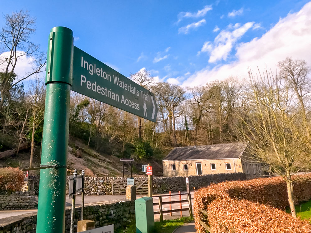
The footpath sign marking the entrance to the Ingleton Waterfalls Trail
The Ingleton Waterfalls Trail car park is quite large. Head to the far end of it, where there is a kiosk and entrance to the walk. There is a charge per person to enter the walk - current charges and opening times are available on the Ingleton Waterfalls Trail website, along with a leaflet that you can download that tells you about the walk and the waterfalls. The walk is nearly all on private land, and the entrance fee, I believe, is to maintain the paths around the walk and insurance. A good time to go is a day or two after heavy or prolonged rain. My personal favourite is late April when the spring flowers are in full bud but before the leaves come back on the trees.
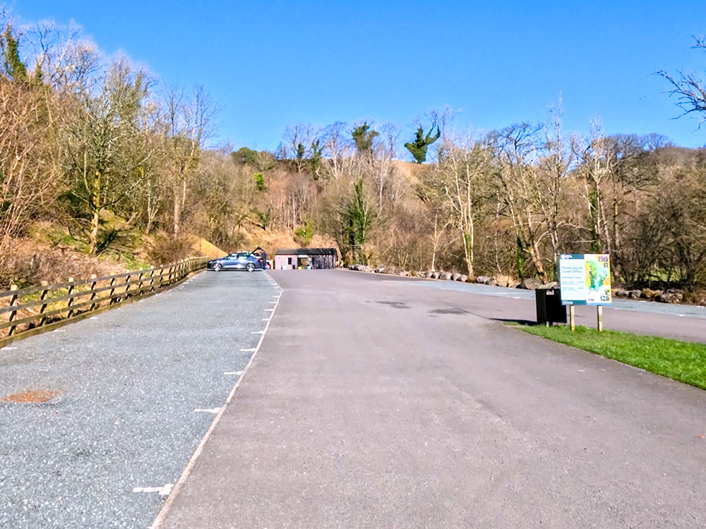
Pay kiosk at the end of the car park
Once you have paid, head along the gravelled path. The path keeps to the side of the river alongside it up the tree lined Swilla Glen. After a while, on this Ingleton Falls walk, you pass by a money tree.
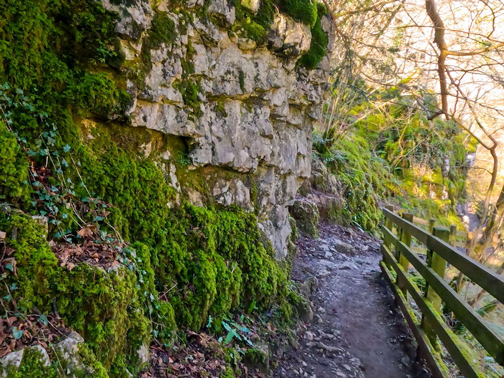
Footpath heading through Swilla Glen
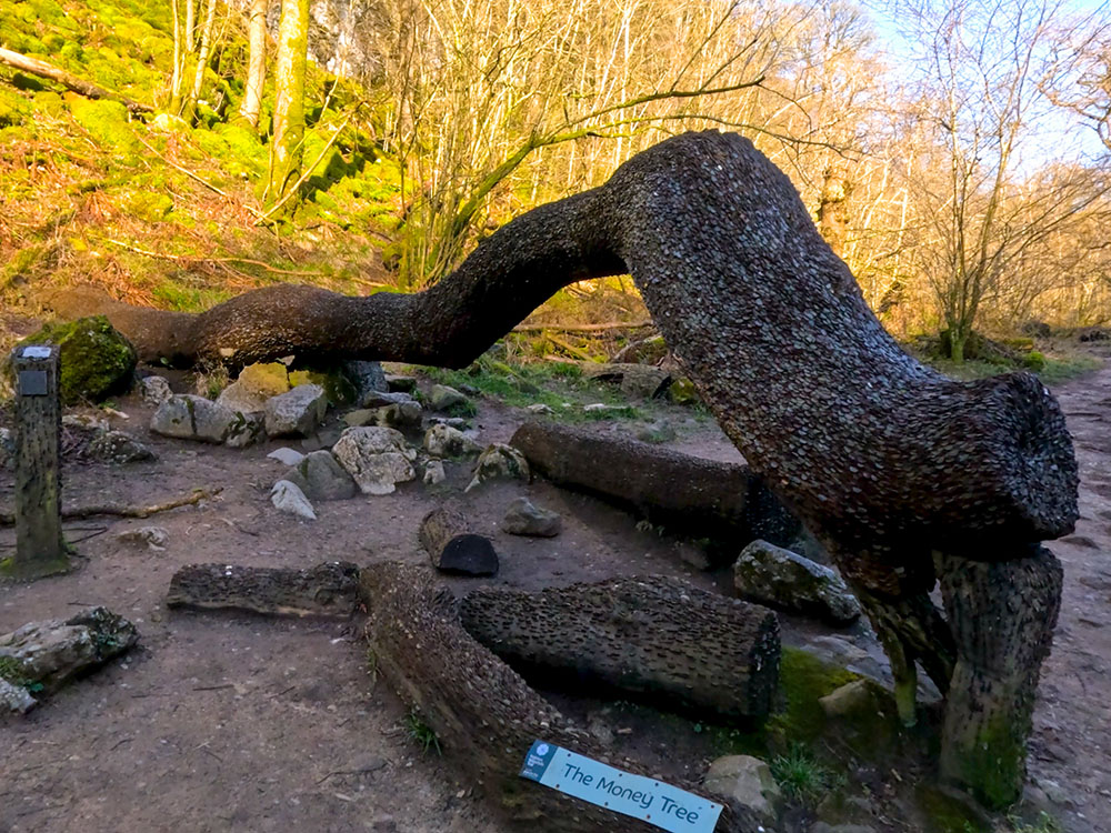
Money Tree in the Ingleton Waterfalls Trail
Then, after about three-quarters of a mile, a footbridge crosses the river, and the path continues up the right-hand bank.
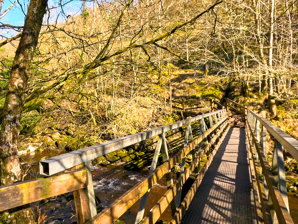
Footbridge over the river Twiss
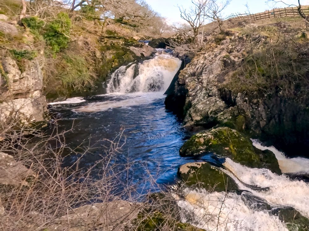
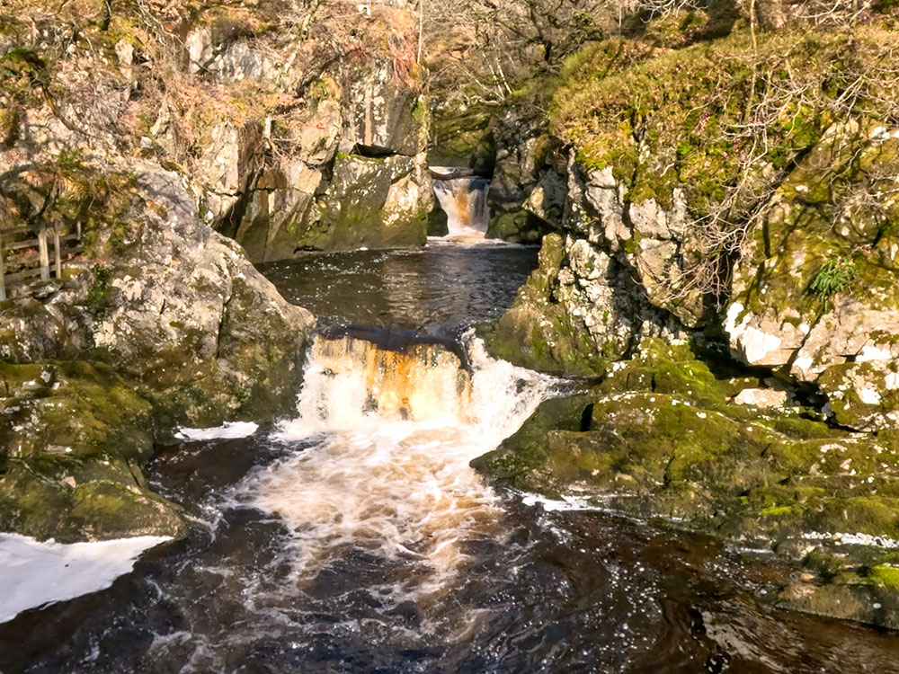
Continuing along the path, a viewpoint is quickly reached, looking across at Pecca Falls. There is a much better view shortly. The path carries on towards Pecca Falls and again crosses a footbridge back across the river directly in front of the falls. From here, you can see the lower Pecca Falls, which are actually a series of five waterfalls that drop 30 metres in height overall.
Lower Pecca Falls
Turn right immediately over the footbridge and follow the path up the side of the falls. As height is gained, you pass by the middle and upper sections of Pecca Falls.
Middle section of Pecca Falls
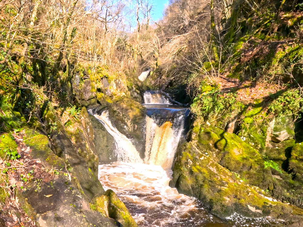
Twin Spout on Pecca Falls
Continue along the path a little further, and you pass by Hollybush Spout.
Hollybush Spout on the Ingleton Waterfalls Trail
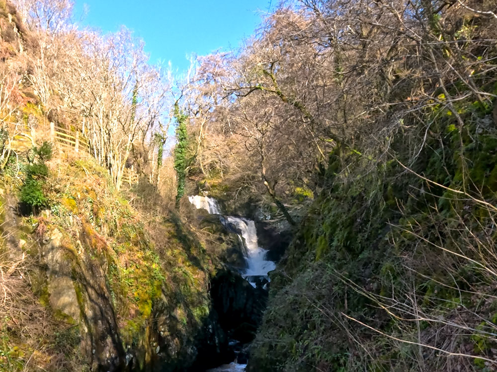
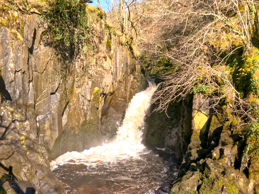
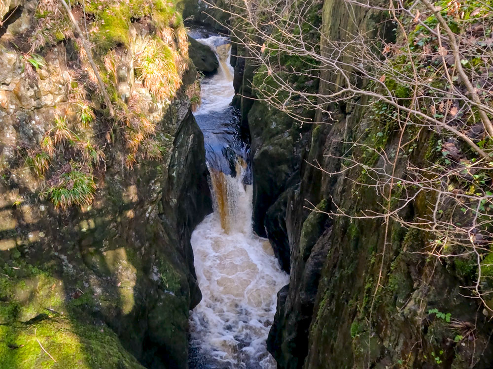
After passing Hollybush Spout, climb the steps and pass through the gate and by a green hut that, on previous occasions when I've passed, did sell refreshments, the path now enters more open countryside as compared to the tree-lined earlier part of the walk. After a few more minutes of walking on this Ingleton Falls walk, Thornton Force is clearly visible ahead. This waterfall is very impressive, even from a distance, but this time is one single fall of 15 metres as compared to the various falls that make up Pecca.
Thornton Force on the Ingleton Waterfalls Trail
After viewing Thornton Force (there are some seats at the bottom of it), the path goes along the left-hand side of the falls and climbs up alongside it. It heads along, past Raven Ray to reach another footbridge. Go over the footbridge, climb the steps and across the field and up to the gate in the wall. Go through the gate and turn right into the walled lane.
Passing by Raven Ray
Continue along the lane, through a kissing-gate and continue along the lane. Just through this kissing gate, there is often an ice cream van parked there. Go through another gate and follow the walled lane around to the left, following the Ingleton Trail Waterfalls sign. Pass down the left-hand side of the buildings and head over a stile in the wall, next to a gate, again following the waterfalls sign. Follow the path away from the wall, initially alongside another wall, before the path veers left to head across the field where straight ahead Ingleborough can now be seen in the distance. The path winds its way down across the field to Oddie's lane.
Footpath across the field with Ingleborough ahead
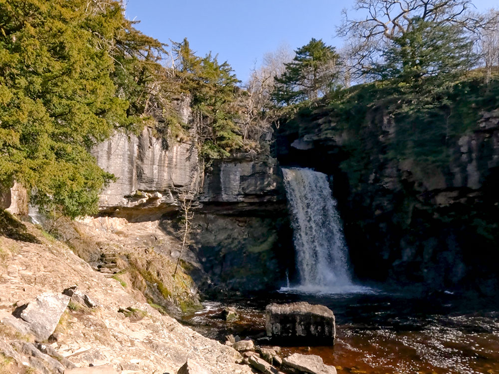
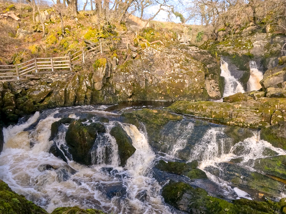
Cross the lane and continue straight ahead down another lane signed for the waterfalls and Falls Park. On your left, you can see the touring pitches of Falls Park. Follow the road as it bends around to the right, then follow the waterfalls sign, branching left between two hedges to pass by a toilet block. Just past that is the Falls refreshment centre. Keep on past that and head down between the hedge and a wall, following the Ingleton Waterfalls Trail sign. The Ingleton Falls footpath drops down to the river Doe at the Beezley Falls.
Top of Beezley Falls
Head down the concrete steps down the side of Beezley Falls, where you pass by the Triple Spout, which is part of the Beezley Falls.

Triple Spout on Beezley Falls
Path alongside Beezley Falls
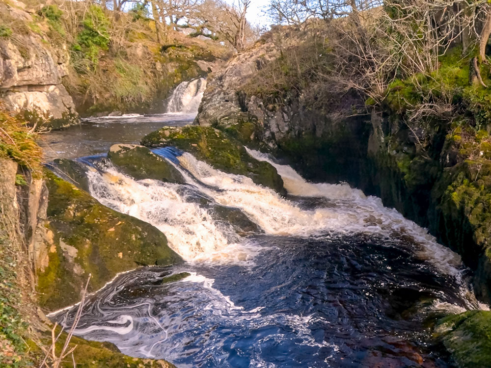
Continue along the path past the Rival Falls.
Rival Falls on the Ingleton Waterfalls Trail
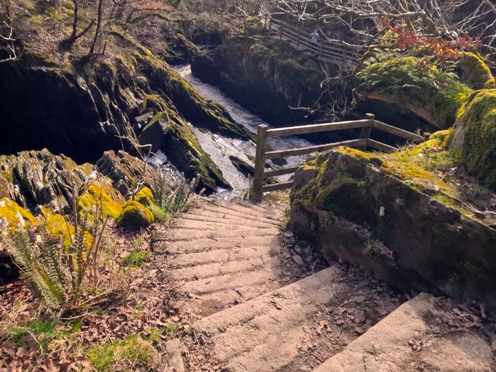
After that, you pass by Baxenghyll Gorge, where there is a viewing platform down some steps that can be used to view the gorge.
Baxenghyll Gorge on the Ingleton Waterfalls Trail
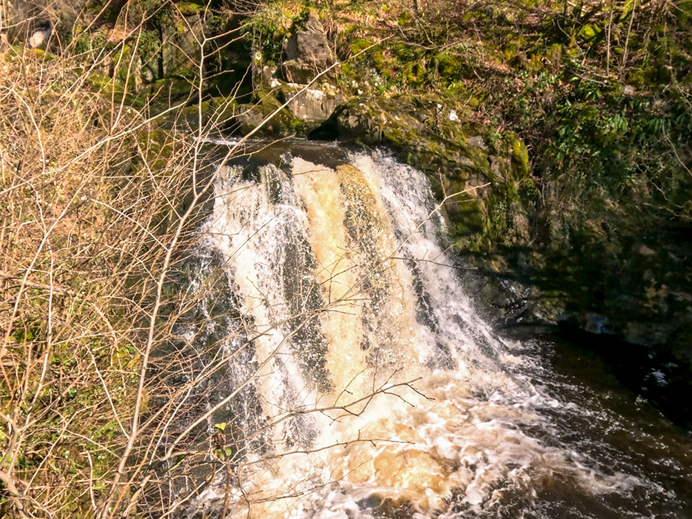
Continuing, you then pass by the Snow Falls.
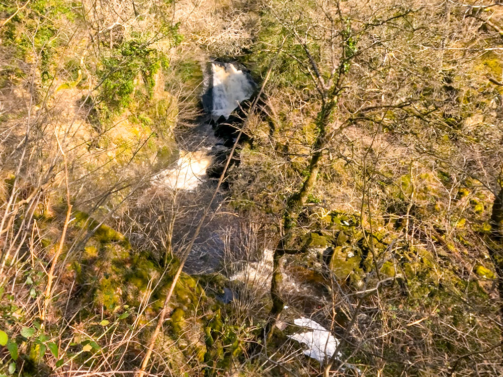
The Snow Falls
After the Snow Falls, the path heads over another footbridge. Over that, follow the path up the steps and through an old quarry to drop down before the path gently climbs up through quarry wood. After passing a small disused building as the path emerges from the trees, the path drops down to and passes through a kissing gate, then over a small wooden bridge before continuing on. Shortly afterwards, the path splits, but either path can be taken as they join together a little further on before passing by the disused brick lime kilns that were part of Storrs Quarry.
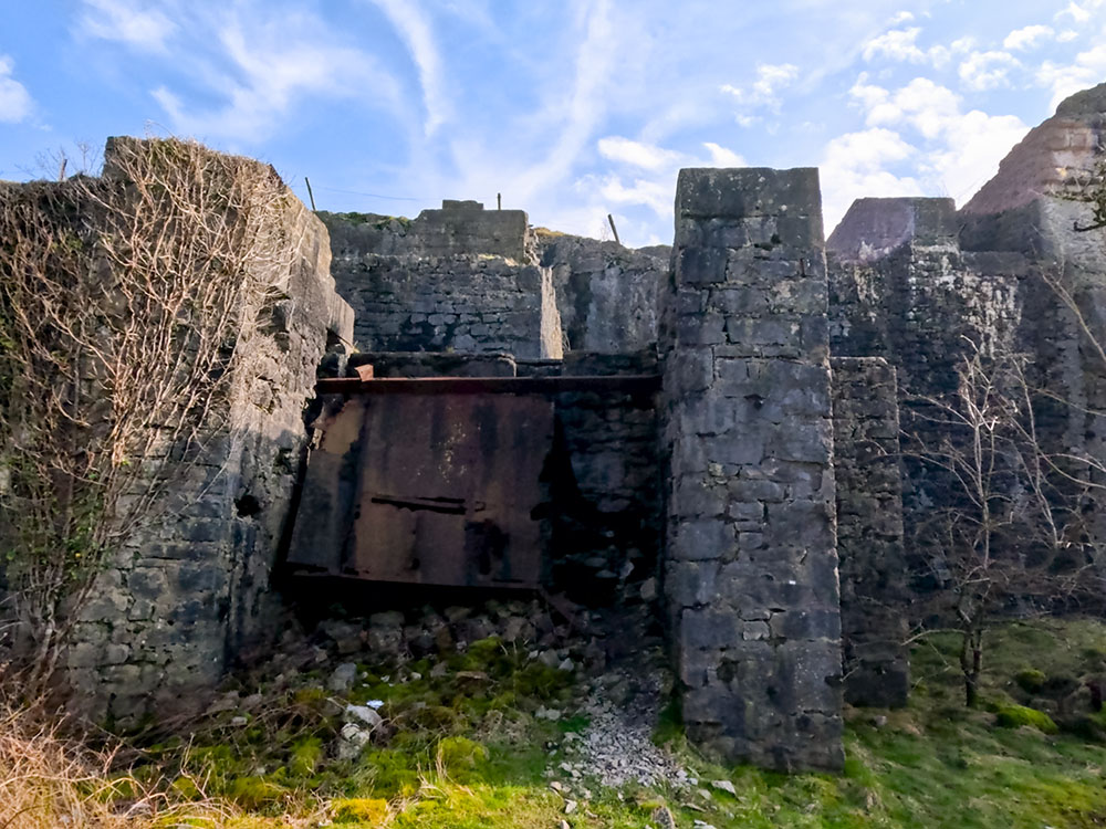
Passing by the disused limestone kilns at Storrs Quarry
Continue along the path, eventually passing through a gate onto Thacking Lane that leads back into Ingleton. Upon reaching 'the square' on a wall on the white building, there is an information sign, showing you where things are in Ingleton. The Ingleton Waterfalls Trail car park is signed from here. You turn right, pass by the church, turn right down the hill and follow the road around to the right, over the bridges over the river Doe and the river Twiss, before turning right, back into the car park.
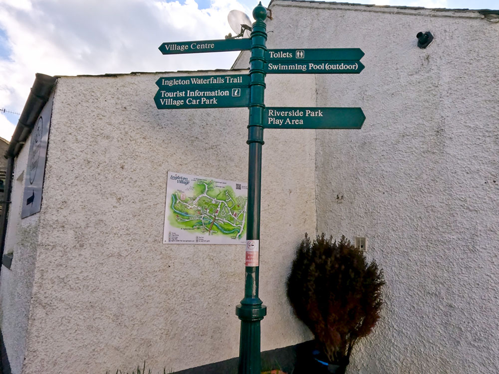
The Ingleton information board in 'the square' in Ingleton
If you want to find out where to eat or drink in Ingleton before, during, or after the walk, have a look at the end of the video above or in the more detailed description of the Ingleton Waterfalls Trail Walk.
If you want to explore more of the area's walks, check out the ultimate guide to Ingleborough.
Click here for Disclaimer
